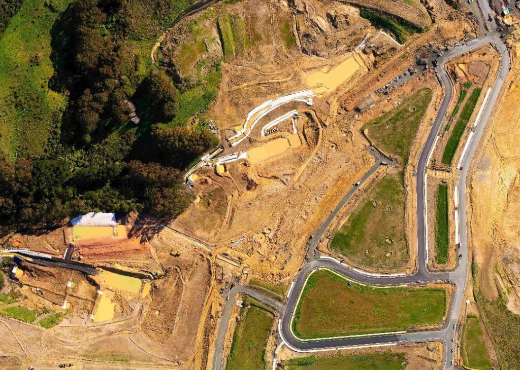
Ortho-Rectified Maps
An ortho-rectified image is adjusted for topographic relief, lens distortion, and camera tilt allowing you to measure true distances. Using a drone to check out a job site is much safer than boots on the ground, especially in hard to reach locations.
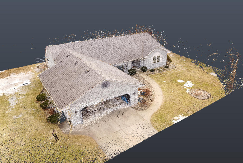
Point Cloud Models
Using photogrammetry software we create Point Cloud models. These point clouds contain millions of data points which can all be tracked back to real world GPS locations. These models are great for clashing against in BIM Coordination.
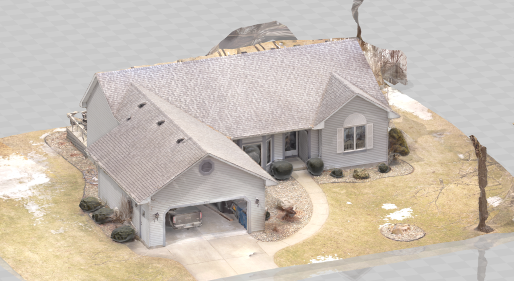
3D Models
By converting the point clouds to surface 3D models, you get a great representation of what is on site and it provides more clarity. These models are great for showing existing conditions, as-built information, and remote site updates.
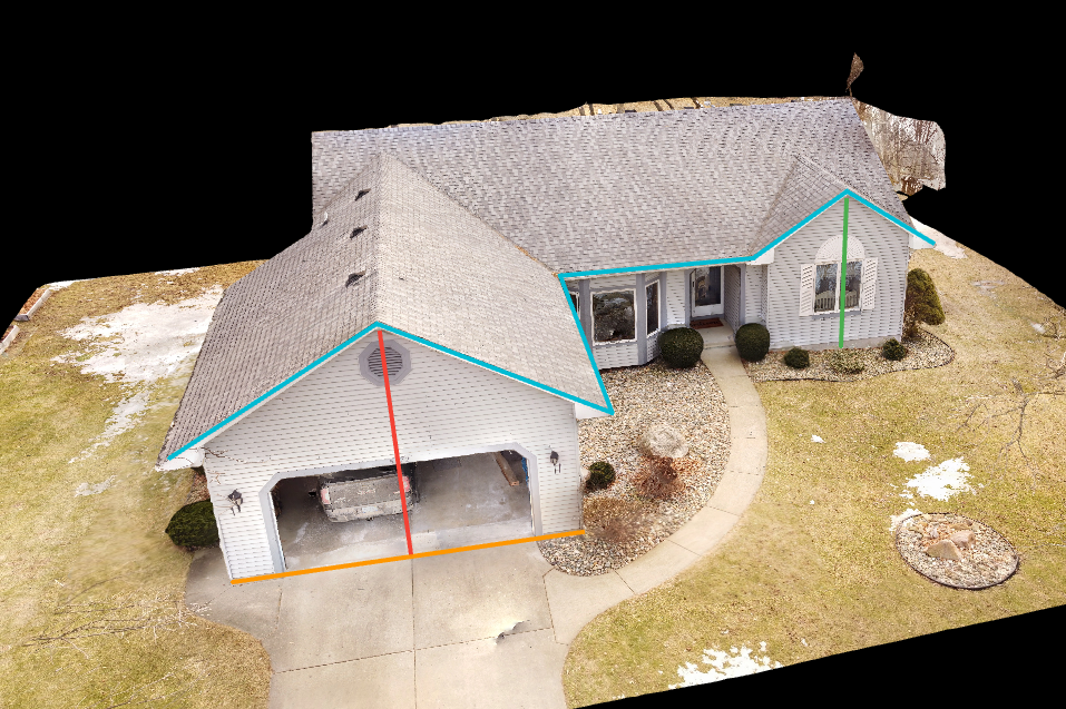
Measure Distances, Areas, and Volumes
The point cloud models and 3D models can both be used to accurately measure distances, areas and volumes. Saving you time and money by removing the need to send someone out to the site to measure by hand.
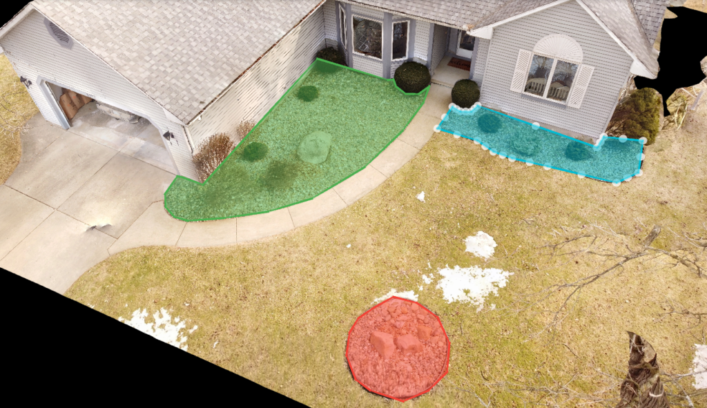
Measure Cut and Fill Sizes
Another great feature of having access to the maps and models is the ability to measure cut and fill sizes. This will save you time and money by providing a more precise estimate of the volume than manual calculations.
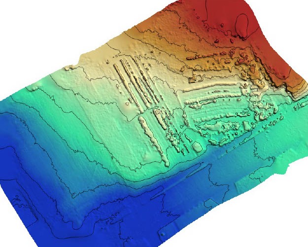
DEM and DTM Models